


Wavve Boating: Marine Boat GPS
4.5536.00 Reviews
App Specs
- Version
- 5.7.8
- Updated On
- License
- Free
- Downloads
- 500,000+
- Developer
- Wavve Boating
- Categories
- Maps & Navigation
- Platform
- Android
Screenshots
 Analysis by AppCompare
I find a boating navigation app most valuable before the boat leaves the dock, not only when I’m already steering. That is where Wavve Boating: Marine Boat GPS makes its best case: it brings chart-based navigation together with weather and tide information, so I can think through a route and check the conditions in one place. It is a free Maps & Navigation app from Wavve Boating, rated 4.6 on average, with over 100,000 installs. Its Everyone age rating makes it broadly accessible, though the practical audience is anyone who spends time planning or navigating trips on the water.
What I would check before casting off
The useful question is not simply whether a map opens, but how much of the trip depends on a working connection. Marine navigation is a setting where mobile coverage can change quickly, and I would not assume that every chart, update, or community detail will be available in every location. I’d open the app while still somewhere with a reliable connection, inspect the route and nearby water, and check the information I expect to need before heading out.
That small habit matters because a phone app is only one part of a safe navigation setup. I would treat it as a helpful reference, not as a substitute for keeping an eye on the water, understanding the route, and carrying whatever backup tools are appropriate for the trip. If the plan includes remote stretches or a long crossing, I would be especially cautious about relying on live information alone.
Useful in the boat, but still a phone app
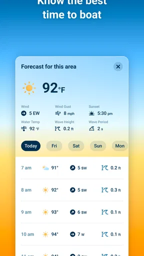
The app’s mix of charts, marine GPS, depths, tides, and weather suits the way many ordinary outings unfold: check the conditions at home, confirm the route at the launch, then refer to the map as the boat moves. I’d use a phone mount or keep the device somewhere secure and easy to glance at, rather than trying to operate it while handling the boat. Screen glare, wet hands, and a moving vessel can make any detailed phone interface less comfortable than it looks on shore.
For a short trip on familiar water, the app can help me keep bearings and revisit a saved point. On a new route, I’d spend more time examining the chart and tides before departure instead of expecting the screen to make decisions for me. The practical trade-off is straightforward: a phone is convenient and familiar, but it depends on battery, visibility, and a device that stays usable in a marine environment.
When the signal or the plan changes
If reception becomes weak, I would not wait until I’m out of coverage to find out what remains accessible. Check the chart and relevant trip details beforehand, and avoid assuming that a live weather or tide view will refresh at the moment you need it. A change in signal is also a good reason to fall back on the route you already reviewed rather than repeatedly tapping the screen and losing attention to what is happening around the boat.
Plans change on the water: wind shifts, a stop takes longer, or a familiar channel looks different in person. I’d use the app to help reassess, but I would compare what it shows with the conditions I can see and with sound local judgement. That is a sensible way to use a mobile navigation tool, especially when connectivity is uncertain.
Worth Reading Before You Choose

EA SPORTS FC Mobile 26 Is a Bigger Football Game, but It Takes Time

Flipboard Shows What News Apps Must Do Beyond the Feed

Switching to Android Auto Means Rethinking Your Driving Routine

Google Calendar Makes a Crowded Week Easier to Manage

Ludo King Makes the Most of the Minutes Between Plans

Baby Panda World Brings Quick Play to Modern Phones, but Its Game Library Feels Busy
Keep the phone’s role in perspective
Frequent map viewing and location use can make a phone’s battery a consideration on a longer day. I’d start with a charged device, reduce unnecessary screen use, and make sure the phone is protected and accessible. Those are simple steps, but they matter more than endlessly refreshing a screen when there is no useful signal.
Wavve Boating is on version 5.4.8 and supports Android 9 or later. The app itself is free, with in-app purchases ranging from $0.99 to $69.99 per item. I’d explore the free experience first and decide whether any paid option fits my regular boating needs, rather than treating a purchase as essential before I know how I use the app.
Chart Your Course with Ease
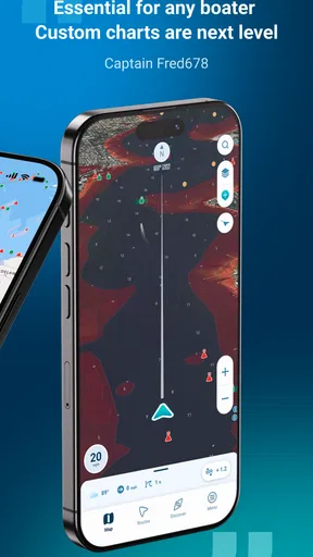
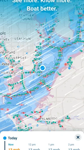
One of the standout features of Wavve Boating is its intuitive interface. As soon as I fired up the app, I was greeted by a user-friendly layout that didn’t require a nautical degree to decipher. The maps are clear, and the ability to customize them by adding personal markers is a game changer. Ever wanted to remember that perfect fishing spot or a hidden cove? Just drop a pin!
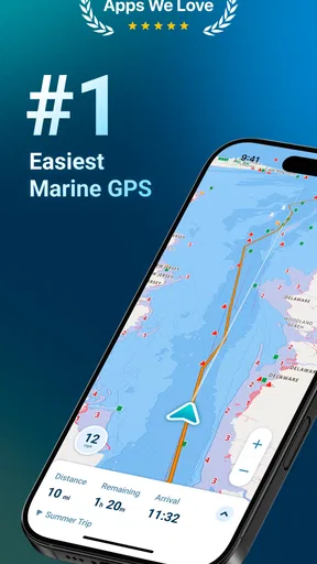
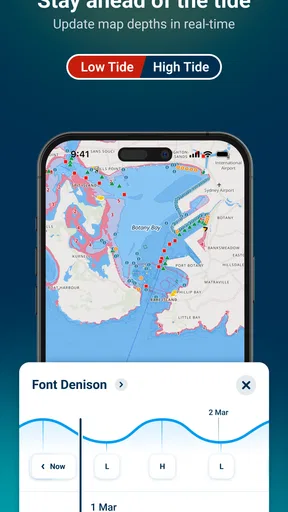
Navigation is a breeze with this app. The GPS is spot-on, offering real-time tracking that’s essential when you’re out on the water. Plus, the app provides tidal information and weather updates, ensuring you’re always prepared for whatever Mother Nature throws your way. I found this feature particularly handy when planning my day trips.
Community at Your Fingertips
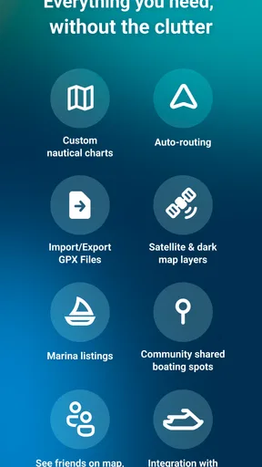
What really sets Wavve Boating apart is its social aspect. The app has a vibrant community feature where users can share tips, spots, and experiences. I stumbled upon some fantastic recommendations for dockside restaurants and scenic anchorages that I wouldn’t have known about otherwise. It’s like having a local guide with you at all times.
Connecting with other boaters through the app is seamless. You can follow other users, comment on their posts, and even create groups for shared adventures. It’s a wonderful way to meet fellow boating enthusiasts and enhance your maritime network.
Safety First
Safety is paramount when you’re on the water, and Wavve Boating doesn’t skimp in this department. The app allows you to share your location with friends and family, providing peace of mind. Whether you’re embarking on a solo expedition or a family outing, this feature ensures someone always knows where you are.
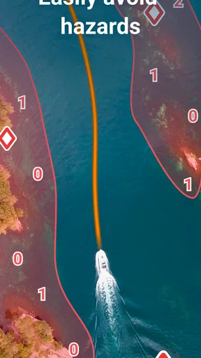
Moreover, the app’s charts are continuously updated, offering the latest information on water depth and hazards. I found this particularly reassuring when navigating unfamiliar waters. It’s like having a co-pilot who’s always on the lookout for any potential dangers.
Room for Improvement
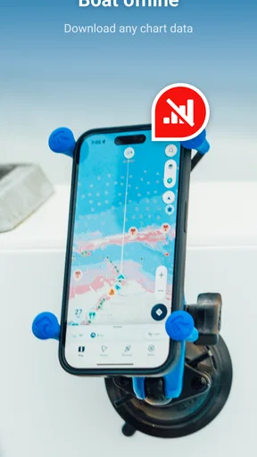
While Wavve Boating is incredibly robust, there’s always room for a little fine-tuning. I noticed that the offline map feature, while handy, could be more comprehensive. For those of us who venture into areas with spotty cell service, having more detailed offline capabilities would be a huge plus.
Additionally, some users might find the initial setup a bit overwhelming with all the features and options available. A more guided onboarding process could help newcomers get the most out of the app from the get-go.
Choosing it over a general map
For a boating trip, a road-focused map is the wrong tool for judging water routes. Wavve Boating is more relevant because its emphasis is on marine charts and conditions, rather than directions between streets. A dedicated chartplotter may remain a better choice for boaters who want a purpose-built helm display or who need equipment suited to demanding, extended trips. I see the app as particularly appealing to recreational boaters who want to plan on a phone and keep useful context close at hand.
There is also a difference between a chart and local knowledge. A marker can help me remember a spot, and another user’s post can suggest a place to stop, but neither guarantees that a route or anchorage is right for my boat on that day. I’d use community recommendations as prompts to investigate, then make my own decision based on conditions, chart information, and the vessel’s needs.
A practical day-trip routine
Imagine planning a relaxed afternoon outing with a couple of friends. Before leaving home, I’d look over the intended route, check the tide and weather details, and mark a likely place to pause. At the launch, I’d confirm that the phone has what I need on screen and tell someone ashore the general plan. While underway, I’d use brief glances to check position, not treat the phone as something to stare at continuously.
If the group decides to stop somewhere different, a saved marker or a community suggestion may help with orientation, but I’d still consider access, depth, and the changing conditions rather than following a pin blindly. This is where the app’s combination of planning information and personal markers feels more useful than opening several unrelated tools. It organizes the decision; it does not make the decision for me.
New boaters may appreciate having chart and trip context in a familiar mobile format, but they should allow time to learn how the map is presented before navigating unfamiliar water. Experienced boaters may find it convenient for route preparation, shared outings, or remembering places they want to revisit. I’d skip using it as my sole navigation resource for a trip where a phone failure or lost connection would leave me without a workable backup.
Who will get the most from it
The strongest fit is someone who takes regular recreational trips, likes to plan before departure, and wants navigation-related information alongside social discoveries from other boaters. It may also suit a newcomer who wants a more water-aware view than a general-purpose map provides. The value is less obvious for someone who rarely boats, never wants community features, or already relies on a dedicated marine system and has no need for a phone-based companion.
One useful habit is to distinguish information that needs to be current from information that is simply helpful to remember. Weather and tide checks belong near the start of planning and may need attention again if the outing changes. Personal markers and notes are more about recall. Keeping those roles separate helps me avoid treating an old saved point or a past recommendation as a live report.
The social side is a genuine extra, but it will not matter equally to everyone. If I mainly want navigation, I can focus on the charts and trip information; if I enjoy exchanging local tips, the community can make planning feel less isolated. I would still be selective about what I rely on, since a popular suggestion is not a guarantee that it suits my route or timing.
Where I would draw the line
Connectivity is the main practical question I would settle before relying on the app for a particular outing. The experience is naturally stronger when I can review and refresh information before departure; it is less reassuring if I expect every detail to remain available unchanged after losing service. I would check what is accessible on my own device and route in advance, rather than making assumptions based on a feature name or on how the app behaved at home.
That does not make the app unsuitable for boating. It means I would match it to the trip: a familiar day on well-known water is a different proposition from a remote passage, a long day with limited charging, or a route where changing conditions demand dependable updates. In those tougher situations, I’d want an appropriate backup and would favor equipment and preparation designed for the demands of the journey.
Another consideration is the initial learning curve. There are several kinds of information to interpret, and the social and planning elements can make the first session feel busier than a simple navigation screen. I’d take a few minutes on shore to locate the chart, understand the markers, and check the sections I expect to use. A little preparation is more useful than trying to learn the interface while underway.
The Final Splash
All in all, Wavve Boating: Marine Boat GPS is a stellar companion for anyone who loves spending time on the water. Its combination of navigation, community, and safety features make it a must-have for boaters of all skill levels. With a few tweaks, it could easily be the definitive app for marine adventures.
So, if you’re ready to take your boating experience to the next level, give Wavve Boating a whirl. Trust me, you won’t look back. Happy sailing!
My connectivity verdict
I’d recommend Wavve Boating as a useful planning and navigation companion for recreational trips, especially when I can prepare before leaving and keep a sensible backup in mind. Its appeal is the combination of marine-focused map use, conditions, personal points, and a boater community—not a promise that a phone will solve every navigation problem in every location.
If I were choosing between this and a general map, I’d choose this for water-specific trip preparation. If my priority were an independent, purpose-built system for a demanding passage, I’d look beyond a phone app or use it only alongside that system. For ordinary outings, the best approach is simple: check what you need while connected, conserve attention and battery underway, and let the app support sound judgement rather than replace it.
Pros
- Intuitive interface for easy navigation.
- Detailed marine maps with real-time updates.
- Offline mode for areas with no signal.
- Customizable routes and waypoints.
- Community sharing of favorite spots.
Cons
- Limited features in the free version.
- Occasional GPS signal drops.
- Battery-intensive on long trips.
- Limited support for smaller lakes.
- Some maps require additional purchase.
FAQs for Wavve Boating: Marine Boat GPS
What is Wavve Boating: Marine Boat GPS?
Wavve Boating is a marine navigation app designed to simplify boating experiences. It offers GPS capabilities, social boating features, and detailed marine charts to help users navigate waterways safely. The app is user-friendly and caters to both novice and experienced boaters, providing essential tools for trip planning and execution.
Is Wavve Boating suitable for beginners?
Yes, Wavve Boating is designed with a user-friendly interface that makes it accessible for beginners. The app provides clear marine charts and easy-to-use navigation tools. Additionally, users can benefit from community-shared points of interest and reviews, helping new boaters learn more about safe and enjoyable routes.
Does Wavve Boating require an internet connection?
Wavve Boating primarily functions offline, allowing users to download charts and use them without an internet connection. However, some features, like real-time updates and community interactions, require internet access. It is recommended to download necessary data before heading out to ensure uninterrupted service.
What devices are compatible with Wavve Boating?
Wavve Boating is available on both Android and iOS devices. It is compatible with smartphones and tablets, providing flexibility for users who prefer different types of devices. Ensure your device meets the app's system requirements for optimal performance and functionality.
Are there any subscription fees for Wavve Boating?
Wavve Boating offers a free trial period, after which users can choose from various subscription plans. The subscriptions unlock premium features like advanced chart layers and enhanced navigation tools. Pricing details can be found within the app, and users can select a plan that best suits their boating needs.


